


Get precise measurements of your stockpiles and excavations volumes, using our drone data services.
We will produce accurate measurements of your stockpiles and excavations volumes – quickly and inexpensively.
The traditional measuring methods, involving survey equipment and personnel, can take considerable time – time that drives up the cost of getting the data.
A small site can be flown in less than an hour by drone – essentially, drone data are already being processed by the time that a traditional crew are just about finished setting up their equipment.
Additionally, the use of drone data, assisted by ground control points, can provide very, very accurate results.
We can produce periodic measurements of your stockpiles in order to enable you to track the usage of your aggregates over time. You can arrange monthly, weekly or even daily measurements of your stocks, providing you with accurate and timely monitoring of their management.
In this way you can independently verify that the amounts of aggregate delivered are as stated, and that their use after delivery is also as stated.
These data therefore amount to a tool that you can use to potentially increase site productivity and profitability.
Parhelion can make data-rich, georeferenced or un-georeferenced maps that are useful for making measurements of objects at your site.
Georeferenced maps are drone orthomosaics that have been aligned to a spatial reference system, using ground control points. All locations and objects within a georeferenced map are identifiable with respect to their location in a local/national/global reference datum (e.g. lat/long in the WGS84). Additionally, the maps are internally consistent, meaning that measurements of and between objects and areas are accurate.
In un-georeferenced maps, locations of objects are not accurately referenced to a given datum, however they are internally consistent, and for many measuring purposes this is perfectly sufficient (also quicker and less expensive)
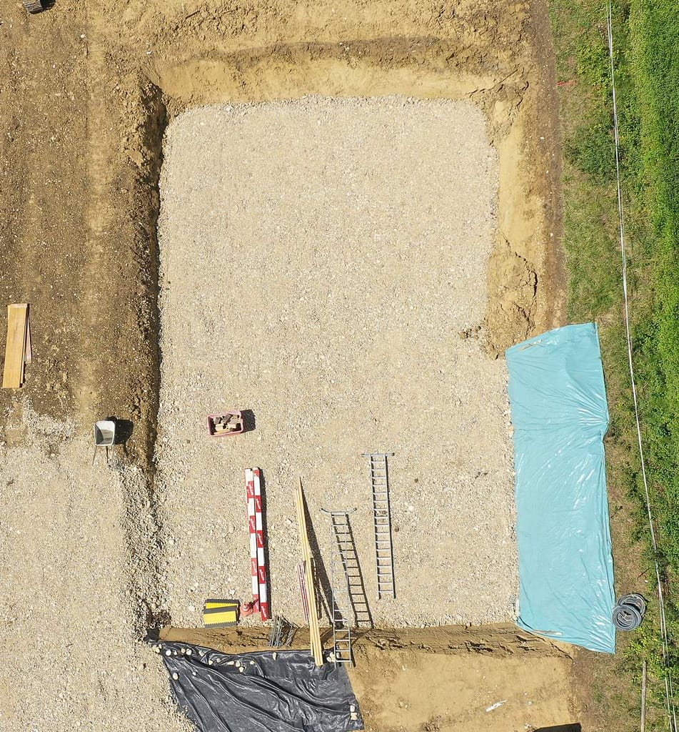
We derived accurate cut and fill volumes for the itreas GmbH architect in charge of a building project in the village of Péry, near Biel.
Using these data, he was able to confirm that the excavation was precisely the size that it should be, and that the amount of material removed, and which will have to be dealt with, is as expected.
Additionally, a load of gravel was brought to the site and the volume of this material was confirmed to be as expected (even after it had been added to the excavation).
Our measurements gave the user the satisfaction of being able to make an independent cross-check of the activities and effectiveness of the builder.
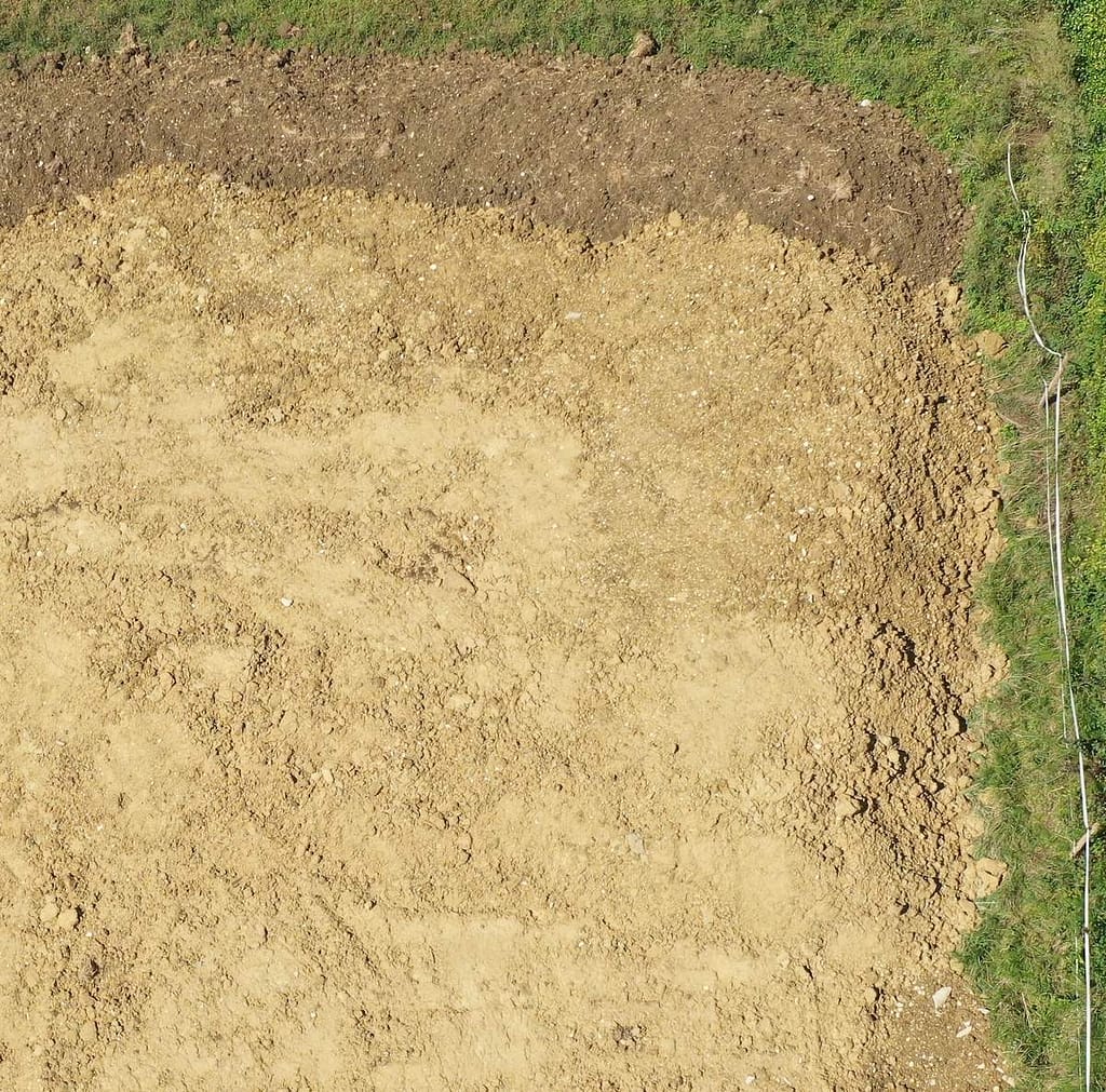
We produced an accurate orthomosaic (map) of the pre-construction area of the Péry building site as part of the itreas GmbH project.
This map permitted the architect to make measurements as needed, and was a useful tool during planning phases of the project.
As shown in the image of part of the map (left), linear, area and slope (not shown) measurements can easily be made.
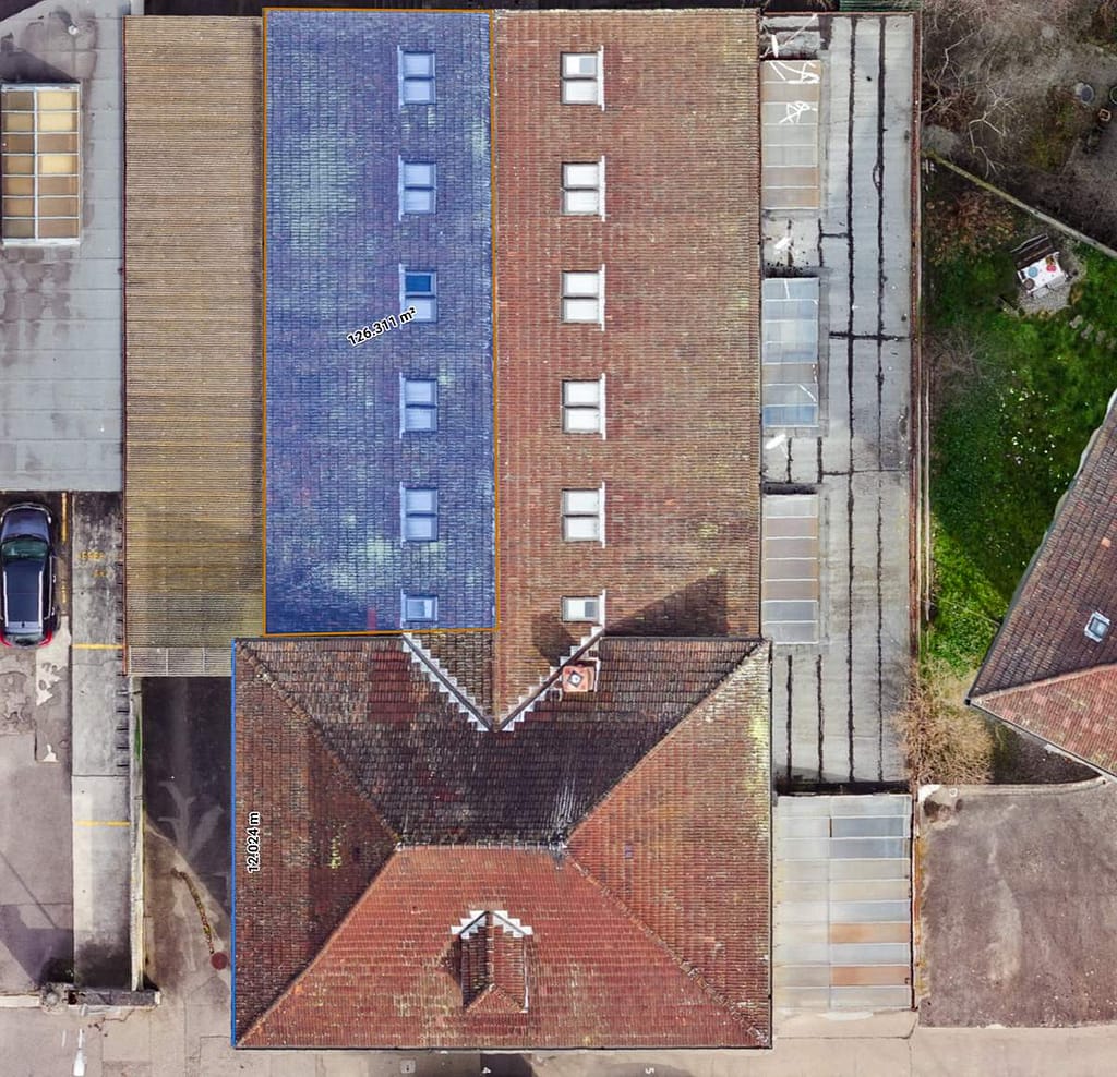
We derived an accurate scale 3D model of the subject building in the 115West° Architekten GmbH project in the city of Biel.
This data product permits the user to measure surface slopes, inclined (3D) distances and inclined areas on the roof of the building, resulting in greater confidence in planning for the installation of a large solar panel array. All without anyone having to climb around on the steep-sloping structure!
We produced an accurate orthomosaic (map) of the intended Biel solar panel array installation site for the 115West° Architekten GmbH project.
This map permits the user to make surface slope, horizontal distance and area measurements as needed, and is a useful tool during planning phases of the project.
is a registered Swiss company (registry of Canton Bern), and is also registered with the Swiss Bundesamt fur Zivilluftfahrt (BAZL) as a commercial drone operator.
Parhelion’s operations and aircraft are insured in accordance with Swiss law by Zürich Versicherungs-Gesellschaft AG.